Streamline traverse reductions, rigorous Bowditch & Transit rule adjustments, hardware-accelerated 2D CAD vector lot drafting, and instant AutoCAD DXF deliverables. 100% offline, zero cloud telemetry, built for extreme field and office reliability.
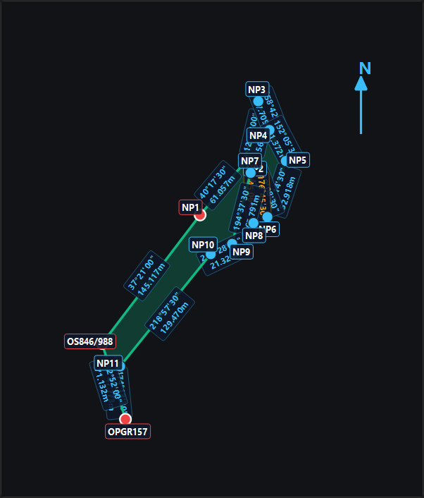
Built around the JTU Sabah cadastral workflow, from the fieldbook to the LAPORAN.
Automated Circle Left/Right (PK/PR) averaging, slope reduction (Δh, Zenith), cumulative angular misclosure distribution, and statutory final rounding to 30" or 10".
High-precision traverse adjustment engine. Calculates fractional coordinates, linear misclosure, and classifies traverse accuracy against Class 1 (1:8,000) and Class 2 (1:4,000) limits.
Rotates bearing and distance text parallel along line angles with upright normalization (-90° to +90°). Station badges automatically compute outward bisectors with dark wipeout masks.
Generate production-ready AutoCAD `.dxf` survey plans with dedicated layers for boundary lines, station markers, bearings, and parcel lot fills in a single click.
Import electronic total station raw files (GDM, GTS) and GNSS observation vectors. Automatic coordinate projection across GDM2000, Borneo RSO, Peninsular RSO, and Cassini-Soldner.
Your client cadastral plans and confidential coordinates are stored solely on your local workstation in an embedded SQLite geodatabase. Zero cloud leaks, zero external telemetry.
Start with a 14-day free trial. Unlock full annual commercial licensing for only RM599/year.
Explore every feature with unrestricted access from the moment you install.
Complete commercial package for licensed surveyors and geomatics consultants.
Instant offline cryptographic verification. No internet required in the field.
Download and install GeoInfinia on your 64-bit Windows PC. Your 14-day free trial activates automatically on first launch.
Open GeoInfinia → click 🔑 License on the top ribbon. Click 📋 Copy HWID (e.g. GI-HWID-BD9A-1835-94D1).
Send your Hardware ID and payment confirmation. You will immediately receive your signed annual activation key valid for 365 days.
Download GeoInfinia v1.6.2 setup installer and start your 14-day free trial today.
🛡️ Note: Downloading the .ZIP package avoids browser executable security blocks. After downloading, extract the ZIP and double-click GeoInfinia_Setup_v1.6.2.exe. If Windows SmartScreen displays "Unknown Publisher", click "More info" → "Run anyway".